
Modernizing Land Records with
Sub-Second Spatial Intelligence
Spectacle transforms fragmented, slow property records into lightning-fast vector parcel maps, automated CAMA appraisal synchronization, and unified spatial intelligence.
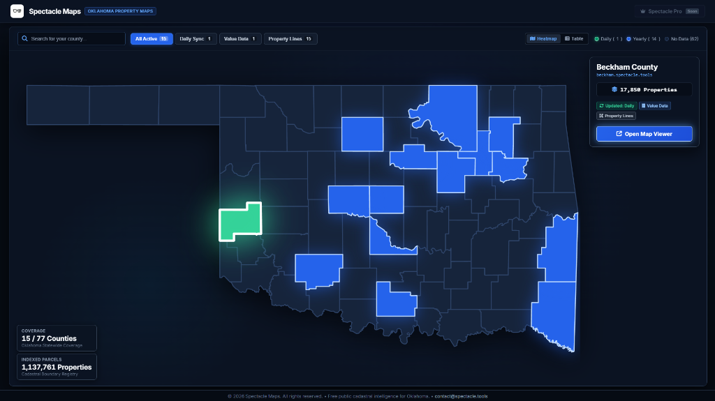
The Oklahoma Spatial Command Center
A unified multi-county parcel directory and interactive vector viewer built for speed, precision, and mobile fluidity.
Why Spectacle Runs Circles Around Legacy GIS
Built from the ground up on modern spatial engineering principles rather than bloated 2000s server architectures.
Sub-Second Vector MVT Streaming
Direct PostGIS Mapbox Vector Tile (MVT) generation streams spatial boundaries straight to browser GPUs via WebGL. No slow server-side raster drawing.
Automated CAMA & Tax Roll Sync
Nightly automated synchronization with county assessor CAMA databases. Binds land valuations, building sq ft, outbuildings, and tax history to parcel boundaries.
Native Section-Township-Range Search
Instant parsing and normalization for Oklahoma Public Land Survey System (PLSS) notations (12-11N-22W, Sec 1 19N 16E) alongside full-text address search.
100% Mobile & Field Ready
Zero-lag touch responsiveness and full mobile spatial navigation. Built for ranchers, appraisers, landmen, and taxpayers standing in the field.
The Spectacle Difference
- ✕ 5 to 10-Second Latency: Server-side raster rendering creates painful lag on every pan and zoom.
- ✕ 77 Fragmented Silos: Every county runs a different, outdated vendor portal with separate logins.
- ✕ Broken on Mobile: Desktop-only layouts that are unusable on smartphones or in the field.
- ✕ Expensive & Walled: Expensive multi-seat licensing or paywalled fees for public property records.
- ✓ Sub-100ms Vector Streaming: Raw polygon geometries rendered on client GPU via WebGL at 60 FPS.
- ✓ Unified Statewide Directory: Instant search across millions of parcels under a single, cohesive hub.
- ✓ Mobile-First Architecture: Instant touch panning, responsive drawers, and deep zoom clarity.
- ✓ 100% Free Public Utility: Modern civic infrastructure that gives taxpayers the transparency they deserve.
Purpose-Built for Oklahoma
Turnkey Public Cadastral Infrastructure
Built for county assessors and public agencies seeking modern, high-performance public maps for taxpayers with automated CAMA synchronization and zero local IT overhead.
Statewide Land Intelligence
Built for landmen, oil & gas operators, wind/solar developers, title abstractors, and appraisers who need rapid Section-Township-Range navigation, legal descriptions, and fresh ownership records.
High-Throughput Spatial APIs
Direct programmatic REST endpoints, bulk parcel GeoJSON streams, and spatial KNN spatial query APIs for utilities, telecom infrastructure, insurance, and proptech platforms.
15 Active Oklahoma Counties
Covering over 1.15 million parcels across major urban metros and rural counties.
Partner with Spectacle
Whether you are a county assessor, state agency, or enterprise land team, let's connect.